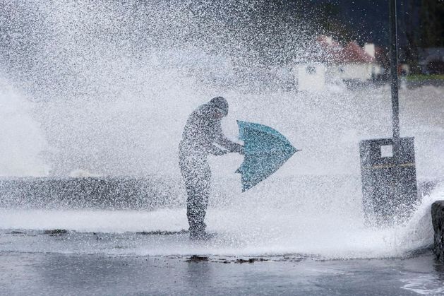
Storm Éowyn: All schools in NI advised to close on Friday due to red weather warning
All schools in Northern Ireland have been advised to close on Friday 24 January 2025.

The Met Office has issued a red alert, which covers all of Northern Ireland from 7am on Friday until 2pm and is warning of "very dangerous conditions" and "widespread disruption".
Education Minister Paul Givan said: “A red weather warning has been issued for Storm Éowyn and the Education Authority has advised that all schools should close tomorrow.
“I understand this will impact on the work of schools and indeed on other businesses and services, but the decision has been taken to avoid any potential risk to life for children and young people as well as staff. Schools should put plans in place today for remote learning so that pupils can study at home.”
Queen’s University Belfast has also taken the decision to close its campus on Friday in response to the red weather warning.
A spokesperson said: “Arrangements in your School or area will be communicated locally.
“Some colleagues will continue to work on campus to carry out crucial roles, delivering and supporting essential services.
“For those colleagues, I would ask you to discuss any impact this may have with your line manager and agree your arrangements for tomorrow as soon as possible.
“As always, ensuring the safety and wellbeing of our people is our first priority and the closure will help minimise the risk to our students and staff."
We have taken the decision to close the university campus tomorrow (Friday, 24 January) in response to the red weather warning of wind in place across Northern Ireland. The strong winds associated with Storm Éowyn are expected to cause very dangerous conditions, widespread disruption and significant impacts.
“All work and teaching delivery arrangements will move online where possible.”
The red warning – the highest Met Office alert – will be in force from 7am until 2pm, affecting all six counties.
According to the Met Office: “Southwesterly then westerly winds will rapidly increase from west to east during the Friday morning rush hour with peak gusts of 80-90 mph fairly widely and perhaps up to 100 mph along some exposed coasts.
"This brings the risk of significant disruption to transport and power supplies, as well as dangerous conditions outdoors. Winds will gradually ease from the south through Friday afternoon.”
An amber weather warning is in place until 9pm in Friday as Storm Éowyn, the first named storm of the year, begins to sweep in.
The public has been warned to take extra care on Friday when Storm Éowyn hits the country. Stock image
‘Weather bomb’ to sweep strong winds and heavy rain across UK this weekend
A yellow weather warning has also been issued for Sunday for strong winds, in place from 8am until 3pm.
The Republic of Ireland is under a Status Red wind warning for Friday, with schools and creches to close tomorrow and workers urged to work from home as Storm Éowyn brings a “danger to life”.
The storm is set to land in the Republic in the early hours of tomorrow morning and has been described as probably “among the severest storms that Ireland has ever seen”.
Yesterday new weather warnings, including an amber warning for wind, were issued with forecasters warning that high winds from Storm Éowyn will bring a “danger to life”.
The forecaster has said that some areas may be affected by winds of up to 90mph on Friday, while the amber warning is in place.
A separate yellow weather warning for strong winds will also come into force from midnight until 11.59pm on Friday.
The severe gale or storm force westerly winds should ease through the afternoon, with showers turning wintry into the evening.
The Met Office warned that injuries and danger to life could occur from flying debris, as well as large waves and beach material being thrown onto sea fronts, coastal roads and properties.
The weather service also warned that power cuts are likely to occur, with the potential to affect other services, such as mobile phone coverage.
They added that road, rail, air and ferry services are likely to be affected, with longer journey times and cancellations possible. Some roads and bridges will close.
A spokesperson for the forecaster said: “Storm Éowyn will move across the northwest of the UK on Friday, clearing to the northeast on Friday night.
"This will bring a spell of very strong west to southwesterly winds, with peak gusts of 60-70 mph fairly widely inland, 70-80 mph in some areas, and 80-90 mph along more exposed coasts and hills (perhaps even higher in a few locations).
"It should be noted that there may be a slight reduction in wind strength for a time as the centre of Storm Éowyn passes overhead, this most likely in parts of Northern Ireland and western Scotland, before winds rapidly increase again. Winds will gradually ease later on Friday.”


